FRANKFURT, Germany, November 29, 2012 /PRNewswire/ —
Full color and low cost make 3D printing accessible to everyone
In a giant step toward the reality of 3D printing for all, Mcor Technologies Ltd has struck a deal with Staples Printing Systems Division to launch a new 3D printing service called “Staples Easy 3D,” online via the Staples Office Centre.
Staples’ Easy 3D will offer consumers, product designers, architects, healthcare professionals, educators, students and others low-cost, brilliantly coloured, photo-realistic 3D printed products from Staples stores. Customers will simply upload electronic files to the Staples Office Centre and pick up the models in their nearby Staples stores, or have them shipped to their address. Staples will produce the models with the Mcor IRIS, a 3D printer with the highest colour capability in the industry and lowest operating cost of any commercial-class 3D printer.
Leica TruView Integrator for SmartPlant® Enterprise Extends the Benefits of Laser Scanning to New Uses in Daily Plant Operations
Through collaboration between Intergraph® Process, Power & Marine and Leica Geosystems, Leica TruView Integrator for SmartPlant® Enterprise significantly improves the way engineering assets are maintained. The solution combines Intergraph’s trusted plant asset management software with Leica Geosystems’ intuitive object information software, extending the benefits of laser scanning from its traditional use of providing accurate as-built information for capital projects to important new uses in daily plant operations.
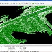
“Technology is advancing so quickly that it’s slowly replacing the surveyor.” These concerns have been voiced over and over as LiDAR scanning becomes more accessible. The most recent advance in scanning is terrestrial mobile LiDAR scanning (TMLS). This technology collects survey-grade data at highway speeds and at traditional survey costs, and in the transportation discipline it is a safer means of data collection while reducing risk for the entire project. But it has surveyors questioning the longevity of their profession. What is seen as a threat because of efficiency must be embraced in order for surveying to survive. Land surveyors are increasingly missing out on surveying work because they are not advancing in current measurement technologies. Understanding and appropriately responding to non-traditional ways will significantly contribute to the success of the surveying profession and to the clients you serve.
https://scanable.com/wp-content/uploads/2012/09/Beach001-e1347454228752.jpg5021906Travis Reinkehttps://scanable.com/wp-content/uploads/2025/01/SCANable_logo_emblemSimple-180x180.pngTravis Reinke2012-09-11 05:19:362015-05-21 20:00:30Embracing Mobile 3D Laser Scanning
Automated Feature Extraction of pipes from point clouds now available for Revit—promises substantial workflow savings of up to 85%
Herndon, Virginia — September 5, 2012 — ClearEdge3D announced today the release of its latest product, EdgeWise MEP™ for Autodesk® Revit®. For the first time, users can bring extracted pipes, conduit and other cylindrical mechanical, electrical, and plumbing (MEP) elements directly into Revit. ClearEdge3D’s new MEP solution leverages the powerful feature extraction technology of EdgeWise to automatically extract pipe solids from laser scan point clouds. These pipe solids can be automatically connected into pipe runs, annotated within EdgeWise MEP, and then brought directly into Revit as fully functional Revit pipe objects. All intelligence extracted by EdgeWise, such as diameter, length, elbow bend radius and more, is also transferred into Revit.
Beta testers of EdgeWise MEP for Revit reported modeling time savings of up to 85 percent over their previous workflows. “EdgeWise MEP for Revit greatly enhances the field-to-finish workflow. It’s the innovation our BIM customers have been asking for,” said Chris Scotton, ClearEdge3D’s President and CEO. “Now users can combine the speed of EdgeWise Automated Feature Extraction with the power of Revit to produce Revit deliverables much faster than ever before.”
Working closely with the Autodesk Revit MEP product management team and a group of highly experienced Revit users, ClearEdge3D developed EdgeWise MEP for Revit to dramatically speed the process of modeling MEP as-builts. “Modeling MEP for BIM has traditionally been a very tedious process,” Scotton continued. “EdgeWise MEP for Revittakes much of the manual modeling out of the workflow and instantly delivers the data straight into Revit as pipe objects, thus reducing a project’s cost and schedule. While the current release focuses on cylinder extraction, future releases will be able to automatically extract square ducting, cable trays and other planar objects.”Kelly Cone, Innovations Director at Beck Architecture, recently tested the beta release. “Edgewise MEP for Revit is a huge step forward in our market. Tasks that used to take us days to complete can now be done in a few hours.” Another beta tester, Devon Kelley at Precision Point, Inc. recently completed a hospital MEP project using the new software. “I am beyond impressed. I was able to simply highlight all the pipe objects and click the “convert to pipes” button. Revit automatically recognized the pipe size which was incredible. So far it has exceeded my expectations. “
To request a live demonstration of EdgeWise MEP for Revit click here: www.clearedge3d.com.
About ClearEdge3D
ClearEdge3D was founded in 2006 by two recognized experts and thought-leaders in the field of computer vision, Automated Feature Extraction, and LIDAR data analysis. The company’s flagship products, EdgeWise Plant™, EdgeWise MEP™ for Revit and EdgeWise Building™, are used by top engineering firms world-wide to optimize their scan-to-model workflow. The company is privately-held and headquartered in Herndon, Virginia.
Autodesk and Revit are registered trademarks or trademarks of Autodesk, Inc., in the USA and other countries.
European firms lag behind as world’s top 100 rental companies’ revenues grow by 13.3% in 2011 [source]
WORLDWIDE equipment rental revenues grew significantly in 2011 as contractors and other equipment users increased their reliance on rental suppliers, according to the latest IRN100 survey of the largest 100 equipment rental companies worldwide, published by KHL Group.
Rental companies in all regions reported revenue growth last year, although European firms lagged behind the rest.
Total rental-related revenues at the world’s top 100 rental companies grew by 13.3% last year, with revenues at the top 10 growing on average by 22.9%, after adjusting for currency changes. The full survey is published in the July-August issue of International Rental News (IRN).
North American rental companies in the list grew, on average, by 17% while European renters reported much more modest growth of 5.9%. US rental giant United Rentals top the list with UK-based power rental company Aggreko at number two.
The 2011 survey reflects wider trends in the global economy, with growth shifting to emerging markets and recovery in the US proving more robust than in Europe. Of the top 100 companies, 44 were from Europe, the lowest number since the survey was started in 2005 and the first time it has been below 50.
Emerging markets continue to increase their participation in the list, with Chinese and Middle East companies in the top 100 for the first time.
Capital expenditure on fleet was also up dramatically in 2011, with the top 25 spenders investing €5.7 billion, gross, in their fleets. This is more than double the €2.5 billion in 2010 and reflects high replacement investment by rental companies in the US, Japan and Australia.
Murray Pollok, the report’s author, said; ‘A mix of factors contributed to the growth in rental last year. Many of the biggest rental companies in North America and Europe saw rental revenues recover from depressed levels in 2009 and 2010, while in developing areas of the world rental companies are expanding rapidly as the rental concept catches on.
‘In addition, many rental firms believe that the current economic uncertainty, and difficulties in obtaining finance, are leading equipment users to source more of their equipment from rental suppliers. This trend is most evident in North America, where rental penetration rates are increasing.’
https://scanable.com/wp-content/uploads/2025/01/SCANable_logo_emblemSimple-180x180.png00Travis Reinkehttps://scanable.com/wp-content/uploads/2025/01/SCANable_logo_emblemSimple-180x180.pngTravis Reinke2012-08-10 10:29:122015-05-21 20:09:54Rental companies returned to growth in 2011
Today’s projects takes us back to AutoCAD, with an update to Kean’s last mentioned here, AutoCAD and the Kinect for v1, as well as using Face Tracking inside of AutoCAD…
The main changes were related to the updated point cloud import workflow, but I also updated the code to allow the user to choose to enter “near mode” (by setting the KINNEAR system variable to 1), and to make sure the reduced set of 10 joints get displayed properly when jigging using either the KINSKEL or KINBOTH commands.
I also tested the British English language pack, and sure enough it did a a much better job of understanding my commands. I’ve left the samples defaulting to US English – just search for and replace “en-US” with “en-GB” (having installed the language pack, of course) to give it a try.
After discovering, earlier in the week, that version 1.5 of the Kinect SDK provides the capability to get a 3D mesh of a tracked face, I couldn’t resist seeing how to bring that into AutoCAD (both inside a jig and as database-resident geometry).
I started by checking out the pretty-cool FaceTracking3D sample, which gives you a feel for how Kinect tracks faces, super-imposing an exaggerated, textured mesh on top of your usual face in a WPF dialog:
I decided to go for a more minimalist (which also happens to mean it’s simpler and with less scary results approach for the AutoCAD integration: just to generate a wireframe view during a jig by drawing a series of polygons…
… and then create some database-resident 3D faces once we’re done:
https://scanable.com/wp-content/uploads/2025/01/SCANable_logo_emblemSimple-180x180.png00Travis Reinkehttps://scanable.com/wp-content/uploads/2025/01/SCANable_logo_emblemSimple-180x180.pngTravis Reinke2012-07-26 20:42:512015-05-21 20:14:05Kinect: Point Clouds and Face Tracking in AutoCAD
The Only Portable Mobile Mapping & GIS Data Collection Solution is now available for daily, weekly and monthly rental.
Mobile Surveying Systems or Mobile Mapping Systems, as they are becoming known, are not new. Several laser manufacturers have introduced and sold Mobile Mapping Systems over the last few years. The difference is that these systems (with one exception) are adaptations of tripod mounted (static) laser scanners. They are all large, very heavy, complicated and very, very expensive.
Measurement Devices Ltd. announces the world-wide availability of Dynascan equipment hire/rental giving even the smallest survey organizations the ability to add mobile mapping to its service offering, enabling them to undertake previously undreamed of ‘detailed 3D, large scale mapping projects’, formerly the domain of large companies or government organizations. Productivity of Laser Surveying Systems will no longer be measured in terms of “Points per Second” but in terms of “Square Miles per Hour” and available for the same cost-effective daily hire rate as static terrestrial 3D laser scanning systems (i.e. Leica Geosystems ScanStation C10, HDS6200, HDS7000).
Furthermore, MDL has assembled a global team of LiDAR industry experts to provide field and office support services and custom-tailored training on “real-world” workflows and procedures. Travis Reinke, Chief Operating Officer of Measurement Devices US, LLC stated, “By providing easy access to the latest technology and expertise, we are able to change the decision-making process. Project managers and the like now have the ability to integrate new technologies into their workflows without the huge risk of taking on large capital expenditures. We’re disrupting the market by introducing mobile mapping to the masses.”
MDL’s new business model of providing ‘complete measurement solutions’ gives greater support to customers with irregular or infrequent resource needs or project specific requirements. Reinke went on to add, “Our highly-skilled team of professionals are available to ensure that first-time users are successful on their first project. We accomplish this by offering a discounted bundled rate for an experienced technician and the mobile system when needed.”
MDL’s mission is:
To assist and enable more end-users in the real-world application of various rapid 3D data capture technology by providing easy access to a comprehensive range of equipment rental, consultancy and education.
To help end-users close the information gap between the Hardware/Software Vendors and the real world.
To empower and educate our client base in order to enhance industry growth and spawn further advancements.
To support customers with irregular or infrequent resource needs or project specific requirements.
With decades of combined experience gained from a real world application of laser measurement systems, MDL’s team of industry professionals has obtained a highly qualified and proven skill set focused on Quarry and Mining Surveying, Dynamic Land Surveying, High Definition Surveying, and Hydrographic Surveying.
Eliminate the Investment Risk
Rent equipment until you’re ready to buy – expense on per project basis.
Take advantage of knowledgeable experts with real world experience to support your project team.
Ramp up or down as needed to keep your capital expenditures minimal.
Rely upon our experience to provide you with practical user information and get more than just a demo.
The Dynascan ‘Plug and Play’ LIDAR system is a fully integrated high speed laser scanner, high accuracy GPS positioning system and Inertial Measurement Unit. The system is light weight, highly portable and may be used on land vehicles or marine vessels to acquire 3D survey quality data of topography, urban developments, industrial plants, including overhead utility cables, bridges, dams, harbors, beaches, rivers and canal banks, and much more.
By fully integrating all the sensors in one package, MDL has eliminated the need for field calibrations as all sensor offset measurements are fixed during the factory calibration process and pre-configured in the data acquisition software. The LIDAR system is shipped ready for operation and can be mobilized in a matter of minutes.
Dynascan system comes complete with data acquisition and post processing software suite which is compatible with all known brand multi-beam echo sounders, swathe sonar systems, positioning systems and Inertial Measurement Units. Data from all available sensors is synchronized, “Time Tagged” and Recorded. Post processed and raw data may be exported to most 3D data base and CAD software packages. Dynascan is highly affordable and represents an unrivalled ‘Price-Performance’ advantage, opening up the benefits of 3D LIDAR to numerous applications and market opportunities.
https://scanable.com/wp-content/uploads/2012/06/198361_194154690711110_211518139_n.jpg356960Travis Reinkehttps://scanable.com/wp-content/uploads/2025/01/SCANable_logo_emblemSimple-180x180.pngTravis Reinke2012-07-13 21:09:562015-05-22 19:48:27Mobile Scanners Enter the Rental Market
Boundaries stay in tact when imported into Civil3D via LandXML export from Topo 2.0
David Langley, Applications Engineer at Leica Geosystems, was kind enough to share a video tutorial of a useful new feature coming in the next release of Cyclone II Topo – version 2.0. In the video below, David demonstrates the software’s ability to easily filter through terrestrial laser scan data to locate and isolate the ground surface. This feature looks to be a great survey industry solution for creating a DTM/TIN from point cloud data by automatically thinning the hardtop surfaces while keeping breaklines and changes in elevation very dense. Using LandXML to transfer the resulting surface to Autodesk Civil3D, the boundaries can also be retained for better control over the final surface.
Leica Geosystems expects to release Cyclone II Topo 2.0 by mid-January 2011. We will be sure to give it a thorough review once we get our hands on it. Watch David’s tutorial below:
Thanks, David for taking the time to create this video and for sharing it with us!
https://scanable.com/wp-content/uploads/2010/12/IITopo.jpg10301920Travis Reinkehttps://scanable.com/wp-content/uploads/2025/01/SCANable_logo_emblemSimple-180x180.pngTravis Reinke2010-12-02 12:48:282015-05-22 19:52:36Leica Cyclone II Topo 2.0 Early Look at New Find Terrain Feature
Tuesday November 30, 2010 – INOVx Solutions, the leader in virtual asset solutions for plants, announces the release of version 5.4 of its RealityLINx® Asset Virtualization® platform. RealityLINx 5.4 includes a number of performance, functional, and usability enhancements. The new release features an entirely new underlying database engine, providing for significantly faster queries of the virtual plant model and associated data. The new RealityLINx release is also now available in a 64-bit version, taking advantage of the superior processing capability of Windows 64 bit architectures. Users will also discover a number of functional and usability improvements in the 5.4 release including private Knowledge Views, customizable tool tips, additional templates, new macro features, and new options for marked points.
A New Milestone in the Leica Geosystems HDS / INOVx Partnership
This latest release of RealityLINx, also breaks ground as the first offering from a partnership with Leica Geosystems HDS to jointly develop and distribute advanced software for converting laser scan data into intelligent plant models. Through this partnership with Leica Geosystems, the RealityLINx platform now incorporates the powerful point cloud engine (pcE) from Leica Cyclone. This combination of Leica and INOVx technologies found in RealityLINx 5.4 enables the transformation of laser scans of as-built assets into highly accurate geometries and intelligent asset models, faster than ever before possible. The Leica Geosystems / INOVx collaboration is grounded in an open solutions approach that can be deployed regardless of the specific type of laser scanner used or plant design software involved. The RealityLINx family of CAD adapters has also been expanded to support the import and synchronization of Leica Cyclone (COE) models into RealityLINx intelligent asset models.
Customers that rely on RealityLINx for creating plant models from laser scans will realize a number of benefits with the 5.4 release, including:
enhancements in assisted, rapid modeling of steel structural elements
display scan points for >10x as many scanner positions
speed up display times by >25x for regions of point clouds that include multiple scanner positions
quickly “clip” or remove undesired scan points near objects of interest, even with >40 regions displayed
eliminate time consuming scan data format conversion and import/export steps
display true color point clouds that look exactly like the real plant object
Finally, this release of RealityLINx also marks an expanded business agreement between Leica Geosystems and INOVx, establishing Leica Geosystems HDS the sole distribution channel for the RealityLINx Model product. Leica Geosystems will also offer, via their global distribution channels, the RealityLINx View and RealityLINx Manage products.
Industry Embracing the Benefits of Plant Models from Laser Scans
The use of 3D laser scanning to capture as-built geometry of plants has grown rapidly. This technology is driving improvements in the accuracy and completeness of Asset Documentation, providing customers with a foundation for better safety and environmental compliance. In addition, industry is increasingly taking advantage of intelligent 3D models developed from laser scans of facilities in order to drive new efficiencies in work processes ranging from design and construction through operations and maintenance. This new Asset Virtualization approach is transforming the way plant assets are managed, across the industry. By enabling the rapid construction of highly accurate models from laser scans, the RealityLINx platform accelerates activities in both Asset Documentation and Asset Virtualization solutions.
“We are pleased to already be delivering on the partnership we announced earlier this year with Leica Geosystems. Over the coming months and years, our combined technologies and efforts in providing tools for the rapid modeling of plant assets will set the standard for the process industries and benefit customers of both Leica and INOVx. Improvements in the creation of intelligent models from laser scans of as-built facilities further accelerates deployment of INOVx’s Asset Virtualization solutions by making these solutions faster, more cost effective, more functional and easier to maintain,” says Costantino Lanza, CEO of INOVx.
“Leica Geosystems is very excited to take this next, important step with INOVx. The new product, RealityLINx 5.4, is not only a great example of the significant productivity advantages of Leica point cloud Engine (pcE) technology in third party point cloud software, but our expanded partnership also provides customers with an even more complete laser scanning product solution offering from Leica Geosystems for the plant market,“ states Juergen Dold, CEO, Leica Geosystems.
About INOVx
INOVx, founded in 1999, provides a platform and solutions for Asset Virtualization® to companies in the process industries worldwide. INOVx’s RealityLINx product enables the creation, management and access to high fidelity three dimensional views of plant assets. These views are used in daily work practices to better communicate and navigate all asset information. INOVx solutions support many plant functions such as reliability, safety, operations, maintenance, inspection, and engineering. INOVx is a pioneer and thought leader in the application of laser scanning technology for the creation of accurate and precise three dimensional models of existing facilities. This Asset Documentation Service offers a reliable and proven way of creating and maintaining the three dimension asset models. INOVx is headquartered in Irvine, California. For more information please visit www.inovx.com..
Leica Geosystems – when it has to be right
With close to 200 years of pioneering solutions to measure the world, Leica Geosystems products and services are trusted by professionals worldwide to help them capture, analyze, and present spatial information. Leica Geosystems is best known for its broad array of products that capture accurately, model quickly, analyze easily, and visualize and present spatial information.
Those who use Leica Geosystems products every day trust them for their dependability, the value they deliver, and the superior customer support. Based in Heerbrugg, Switzerland, Leica Geosystems is a global company with tens of thousands of customers supported by more than 3’500 employees in 28 countries and hundreds of partners located in more than 120 countries around the world. Leica Geosystems is part of the Hexagon Group, Sweden.
https://scanable.com/wp-content/uploads/2010/12/inovx_Logo.gif50150Travis Reinkehttps://scanable.com/wp-content/uploads/2025/01/SCANable_logo_emblemSimple-180x180.pngTravis Reinke2010-12-02 10:16:182015-05-22 19:56:58INOVx Announces Release of RealityLINx 5.4 and Leica HDS pcE Support
Pointools has unveiled a Plug-in for Google SketchUp in time for the European LiDAR Mapping Forum, Autodesk University and SPAR Europe. The new Pointools Plug-in for SketchUp streamlines scan-to-model workflows for all SketchUp and SketchUp Pro users by enabling reuse of the largest point cloud models, and by providing a first-of-a-kind solution to create 3D city models from mobile scan data.
Like the Pointools Plug-ins for Rhino and AutoCAD applications, the Pointools plug-in for SketchUp eliminates the need for time-wasting translations, maintains visual quality and accuracy of point cloud models in SketchUp, and increases modeling productivity by reading the Pointools POD model file format to display billions of points on screen.
“This is great news for Google SketchUp and SketchUp Pro users,” commented Joe Croser, VP Products at Pointools. “The Pointools plug-in for SketchUp has been designed from the ground-up to take full advantage of SketchUp’s modelling environment and supports Google’s geo-location services to coordinate StreetView textures and aerial imagery alongside point clouds.”
The Pointools Plug-in for SketchUp extends Pointools’ leadership as an enabler for reusing the largest point cloud models inside the broadest range of applications. Croser continued, “Through our Vortex platform and widely-used software plug-ins, thousands of Autodesk, Bentley, and Rhino users have been able to benefit from streamlined point cloud model reuse across different applications by eliminating time-wasting translations. Now, the Pointools Plug-in for SketchUp, enables the same users to increase their return on investment (ROI) from 3D laser scan data by also reusing the same point cloud models inside SketchUp.”
Google SketchUp is a modelling programme originally designed for architectural, civil and mechanical engineers as well as filmmakers, game designers and other design professionals. With both Professional and Freeware versions, SketchUp is easy and intuitive to use – allowing design professionals to draw the way they want by emulating the feel and freedom of working with pen and paper.
https://scanable.com/wp-content/uploads/2010/11/pointools-sketchup.jpg576576Travis Reinkehttps://scanable.com/wp-content/uploads/2025/01/SCANable_logo_emblemSimple-180x180.pngTravis Reinke2010-11-30 10:11:132015-05-22 20:00:21Pointools introduces Point Cloud plug-in for Google SketchUp

 FRANKFURT, Germany, November 29, 2012 /PRNewswire/ —


 approach for the AutoCAD integration: just to generate a wireframe view during a jig by drawing a series of polygons…