The conference kicked off this morning with some great presentations including a live preview of Cyclone 7.2 and its new pcE high speed visualization engine.
Some of the more interesting presentations today also included:
– Explosion Dynamics Research/Forensic Investigations using HDS, presented bu Dr. John DeHaan, FireEx Forensics
– Ken Smerz, Kovach Construction/Precision 3D Scanning, gave an excellent presentation on the benefits of laser scanning for the precise fabrication of complex wall systems.
– Alan Barrow, ABA Surveying, showed how he is using 3 HDS6000’s, a LandINS IMU and Javad GNSS mounted on the back of a van for near survey-grade mobile scanning.
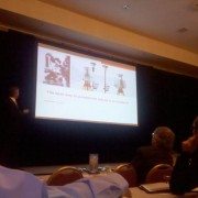
– Luncheon keynote updating us on the status of the Mt. Rushmore CyArk project was given by Liz Lee and Doug Pritchard. They showed some remarkable images of the project.
– Zebra Imaging is displaying their latest high-resolution, full-color holographic prints in their booth. They have some great examples of full-color point clouds and detailed Building Information Models.
The day ended with a great social evening of food and bocce at Campo di Bocce Ristorante & Bar.
We are looking forward to more great presentations over the next couple of days. Be sure to follow us at www.twitter.com/scanable for live updates throughout the event.
https://scanable.com/wp-content/uploads/2010/10/lwuc2010.jpg478640Travis Reinkehttps://scanable.com/wp-content/uploads/2025/01/SCANable_logo_emblemSimple-180x180.pngTravis Reinke2010-10-25 12:34:532015-05-26 19:02:01Leica Geosystems 2010 HDS Worldwide User Conference – Day 1
On Sepember 1, 2009, Leica Geosystems and Point of Beginning Magazine hosted a webinar titled The Business of Laser Scanning — hype or competitive advantage? Presenters Michael Harvey and Frank Hahnel along with Kristi Grahl discussed using laser scanning technology to:
Submit more competitive bids — and win more jobs — for both high-end projects and routine surveys.
Meet the requirements of customers who increasingly incorporate HDS into their project specifications.
Lower your labor costs and increase profit margins on every job.
Increase customer satisfaction with more accurate and detailed surveying reports.
During the webinar, the presenters also announced the availability of Leica’s new ScanStation C10 self-contained time-of-flight 3D laser scanner along with Cyclone 7, Cloudworx for SmartPlant3D and Forensic Map.
Quick Pitch: Automatically extract vector planar surfaces from just about any type of point cloud data.
Overview: Having used just about every piece of software on the market related to processing and extracting vector data from point clouds, I am always looking for the next best thing. The hardware side of laser scanning has come a long way in a very short period of time. However, the software side has not improved at the same blistering pace. When the availability of ClearEdge3D’s EdgeWise™ software was announced back in June and webinars were hosted to demonstrate the abilities of the software, I was anxious to get my hands on a copy of EdgeWise™ to test it out for myself. While a little reluctant to offer demo licenses in the beginning, ClearEdge3D quickly began to realize that skeptics like myself were not willing to spend $7,000.00 on a piece of software that we have not had a chance to try out for ourselves, especially in this economy. They quickly began to recognize the needs of the market and responded accordingly by providing time-based pre-release beta trials to highly interested parties.
Installation:
The pre-release software I received (v. 1.0.2b) was easy to install, although there was an issue with the hardware lock driver on my Vista 64-bit laptop. This was quickly resolved by downloading the correct driver from the SafeNet website (Note: the updated drivers will be included on future distrobutions).
First Impression:
Right out of the box (figuratively speaking, as the software was downloaded from their website) I was very impressed with the overall look and feel of the software. ClearEdge3D was obviously interested in making their software easy to use and graphically pleasing to the eye because they certainly did accomplish that. The UI is based on the latest Microsoft Office-type menu structure which made it very easy to jump right in.
Ease of Use:
ClearEdge3D insisted on a 1-hour web-based training session and, while not necessarily needed due to the exceptional design and layout of the software itself, it did prove to be very benefical and probably saved me a bit of time learning by trial and error. With exception to a few terminology questions, I found the software’s left-to-right workflow very easy to use. Every step of the conversion process was very well thought out and the routines made a lot of sense.
https://scanable.com/wp-content/uploads/2025/01/SCANable_logo_emblemSimple-180x180.png00Travis Reinkehttps://scanable.com/wp-content/uploads/2025/01/SCANable_logo_emblemSimple-180x180.pngTravis Reinke2009-08-04 21:29:562009-08-04 21:29:56REVIEW: ClearEdge3D EdgeWise – Automatic Point Cloud to 3D Model Conversion
Quick Pitch: Automatically extract vector planar surfaces from point cloud data.
Overview: Having used just about every piece of software on the market related to processing and extracting vector information from point cloud data, I am always looking for the next best thing that will make my life and my team’s life easier. We have seen the hardware side of laser scanning come a long way in a very short period of time; however, the software side has not improved at the same blistering pace.
When the availability of ClearEdge3D’s EdgeWise™ software was announced here back in June and webinars were hosted to demonstrate the abilities of the software, I was anxious to get my hands on a copy of it to test it out for myself. While a little reluctant to offer demo licenses in the beginning, ClearEdge3D quickly began to realize that skeptics like myself were not willing to spend $5,000.00 on a piece of software that we have not had a chance to try out for ourselves, especially in this economy. They quickly began to recognize the needs of the market and responded accordingly by providing time-based pre-release beta trials to highly interested parties.
Installation:
The pre-release software I received (v. 1.0.2b) was easy to install, although there was an issue with the hardware lock driver on my Vista 64-bit laptop. This was quickly resolved by downloading the correct driver from the SafeNet website (Note: the updated drivers will be included on future distributions).
First Impression:
Right out of the box (figuratively speaking, as the software was downloaded from their website) I was very impressed with the overall look and feel of the software. ClearEdge3D was obviously interested in making their software easy to use and graphically pleasing-to-the-eye because they certainly did accomplish that. The UI is based on the latest Microsoft Office-type menu structure which made it very easy to jump right in.
Ease of Use:
ClearEdge3D insisted that I attend a 1-hour web-based training session and, while not necessarily needed due to the exceptional design and layout of the software itself, it did prove to be very beneficial and probably saved me the headache of learning by trial and error. With exception to a few terminology questions, I found the software’s left-to-right workflow very easy to use. Every step of the software’s conversion process was very well thought out and the routines made sense, technically speaking.
Technical Aspects: While the software was primarily designed for the Architectural/BIM workflow, I have to admit that I was a little skeptical about the benefits of automatic conversion vs. the time needed to export the point cloud data to a format EdgeWise™ would accept (non-gridded PTX was the format of choice). Having been in the terrestrial laser scanning business over nine years, I know that point cloud data can be very cumbersome to deal with, especially when having to export to different formats. However, I was pleasantly surprised with EdgeWise’s ability to quickly import the various PTX files that I wanted to test.
NOTE: For those Cyclone users out there, EdgeWise™ is an automated “region grow patch, extend patch to all” batch routine. It really does a great job of quickly identifying planar surfaces and extending the edges to meet adjacent planes. The data import and processing time was a lot faster than I expected, but I did drastically reduce the number of points (to about 1 million).
Workflow:
Export point cloud data (individual scans) to format accepted by EdgeWise™ (see FAQ on company’s website for more information on formats)
Import individual scans into EdgeWise™
Follow a few simple steps to identify the location of the scanner
Extract ground surface (TIN)
Let the software work its magic – it really is as simple as that!
Summary:
If you have a significant amount of basic models that need to be created from point cloud data, EdgeWise™ would likely be a good investment. Keep an eye on this product, because they are definitely on to something and, with a little direction from qualified users, they are on track to change our typical workflow.
https://scanable.com/wp-content/uploads/2025/01/SCANable_logo_emblemSimple-180x180.png00Travis Reinkehttps://scanable.com/wp-content/uploads/2025/01/SCANable_logo_emblemSimple-180x180.pngTravis Reinke2009-08-04 15:05:172009-08-04 15:05:17REVIEW:: ClearEdge3D EdgeWise™ – High Definition CAD Models Automatically From Point Clouds

 Some of the benefits of the new
  Company: ClearEdge3D
 Ease of Use: