Rent or Buy Leica Geosystems Cyclone 9

Leica Geosystems HDS Introduces Patent-Pending Innovations for Laser Scanning Project Efficiency

With Leica Cyclone 9.0, the industry leading point cloud solution for processing laser scan data, Leica Geosystems HDS introduces major, patent-pending innovations for greater project efficiency. Innovations benefit both field and office via significantly faster, easier scan registration, plus quicker deliverable creation thanks to better 2D and 3D drafting tools and steel modelling. Cyclone 9.0 allows users to scale easily for larger, more complex projects while ensuring high quality deliverables consistently.

Greatest advancement in office scan registration since cloud-to-cloud registration
When Leica Geosystems pioneered cloud-to-cloud registration, it enabled users – for the first time – to accurately execute laser scanning projects without having to physically place special targets around the scene, scan them, and model them in the office. With cloud-to-cloud registration software, users take advantage of overlaps among scans to register them together.

“The cloud-to-cloud registration approach has delivered significant logistical benefits onsite and time savings for many projects. We’ve constantly improved it, but the new Automatic Scan Alignment and Visual Registration capabilities in Cyclone 9.0 represent the biggest advancement in cloud-to-cloud registration since we introduced it,” explained Dr. Chris Thewalt, VP Laser Scanning Software. “Cyclone 9.0 lets users benefit from targetless scanning more often by performing the critical scan registration step far more efficiently in the office for many projects. As users increase the size and scope of their scanning projects, Cyclone 9.0 pays even bigger dividends. Any user who registers laser scan data will find great value in these capabilities.“

With the push of a button, Cyclone 9.0 automatically processes scans, and digital images if available, to create groups of overlapping scans that are initially aligned to each other. Once scan alignment is completed, algorithmic registration is applied for final registration. This new workflow option can be used in conjunction with target registration methods as well. These combined capabilities not only make the most challenging registration scenarios feasible, but also exponentially faster. Even novice users will appreciate their ease-of-use and ready scalability beyond small projects.

Power user Marta Wren, technical specialist at Plowman Craven Associates (PCA – leading UK chartered surveying firm) found that Cyclone 9.0’s Visual Registration tools alone sped up registration processing of scans by up to four times (4X) faster than previous methods. PCA uses laser scanning for civil infrastructure, commercial property, forensics, entertainment, and Building Information Modelling (BIM) applications.

New intuitive 2D and 3D drafting from laser scans
For civil applications, new roadway alignment drafting tools let users import LandXML-based roadway alignments or use simple polylines imported or created in Cyclone. These tools allow users to easily create cross section templates using feature codes, as well as copy them to the next station and visually adjust them to fit roadway conditions at the new location. A new vertical exaggeration tool in Cyclone 9.0 allows users to clearly see subtle changes in elevation; linework created between cross sections along the roadway can be used as breaklines for surface meshing or for 2D maps and drawings in other applications.

For 2D drafting of forensic scenes, building and BIM workflows, a new Quick Slice tool streamlines the process of creating a 2D sketch plane for drafting items, such as building footprints and sections, into just one step. A user only needs to pick one or two points on the face of a building to get started. This tool can also be used to quickly analyse the quality of registrations by visually checking where point clouds overlap.

Also included in Cyclone 9.0 are powerful, automatic point extraction features first introduced in Cyclone II TOPO and Leica CloudWorx. These include efficient SmartPicks for automatically finding bottom, top, and tie point locations and Points-on-a-Grid for automatically placing up to a thousand scan survey points on a grid for ground surfaces or building faces.

Simplified steel fitting of laser scan data
For plant, civil, building and BIM applications, Cyclone 9.0 also introduces a patent-pending innovation for modelling steel from point cloud data more quickly and easily. Unlike time consuming methods that require either processing an entire available cloud to fit a steel shape or isolating a cloud section before fitting, this new tool lets users to quickly and accurately model specific steel elements directly within congested point clouds. Users only need to make two picks along a steel member to model it. Shapes include wide flange, channel, angle, tee, and rectangular tube shapes.

Faster path to deliverables
Leica Cyclone 9.0 also provides users with valuable, new capabilities for faster creation of deliverables for civil, architectural, BIM, plant, and forensic scene documentation from laser scans and High-Definition Surveying™ (HDS™).

Availability
Leica Cyclone 9.0 is available today. Further information about the Leica Cyclone family of products can be found at http://hds.leica-geosystems.com, and users may download new product versions online from this website or purchase or rent licenses from SCANable, your trusted Leica Geosystems representative. Contact us today for pricing on software and training.

Eyesmap 3D Scanning Tablet

3D Sensing Tablets Aims To Replace Multiple Surveyor Tools


Source: Tech Crunch

As we reported earlier this year, Google is building a mobile device with 3D sensing capabilities — under the Project Tango moniker. But it’s not the only company looking to combine 3D sensing with mobility.

Spanish startup E-Capture R&D is building a tablet with 3D sensing capabilities that’s aiming to target the enterprise space — for example as a portable tool for surveyors, civil engineers, architects and the like — which is due to go on sale at the beginning of 2015.

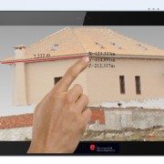
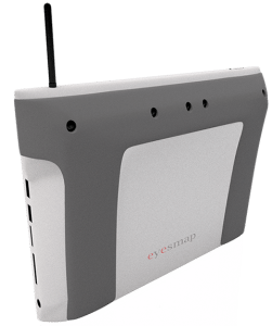
The tablet, called EyesMap, will have two rear 13 megapixel cameras, along with a depth sensor and GPS to enable it to measure co-ordinates, surface and volumes of objects up to a distance of 70 to 80 meters in real-time.

Eyesmap 3D Scanning Tablet


So, for instance, it could be used to capture measurements of – or create a 3D model of — a bridge or a building from a distance. Or to model objects as small as insects so it could be used to 3D scan individual components by civil engineers, for instance.

Its makers claim it can build high-resolution models with HD realistic textures.

EyesMap uses photogrammetry to ensure accurate measurements and to build outdoor 3D models, but also has an RGBD sensor for indoor scanning.

Eyesmap 3D Scanning TabletThe tablet will apparently be able to scan an “advanced photogrammetric picture” with up to 4 million dots in around 2 minutes. It will also be able to capture 3D objects in motion. It’s using a blend of computer vision techniques, photogrammetry, visual odometer, “precision sensor fine tuning” and other image measuring techniques, say its makers.
E-Capture was founded back in April 2012 by a group of experienced surveyors and Pedro Ortiz-Coder, a researcher in the laser scanning and photogrammetry field. The business has been founder funded thus far, but has also received a public grant of €800,000 to help with development.

In terms of where EyesMap fits into the existing enterprise device market, Ortiz-Coder says it’s competing with multiple standalone instruments in the survey field — such as 3D scanners, telemeters, photogrammetry software and so on — but is bundling multiple functions into a single portable device.

“To [survey small objects], a short range laser scanner is required but, a short-range LS cannot capture big or far away objects. That’s why we thought to create a definitive instrument, which permits the user to scan small objects, indoors, buildings, big objects and do professional works with a portable device,” he tells TechCrunch.

“Moreover, there wasn’t in the market any instrument which can measure objects in motion accurately more than 3-4 meters. EyesMap can measure people, animals, objects in motion in real time with a high range distance.”

The tablet will run Windows and, on the hardware front, will have Intel’s 4th generation i7 processor and 16 GB of RAM. Pricing for the EyesMap slate has not yet been announced.


Another 3D mobility project we previously covered, called LazeeEye, was aiming to bring 3D sensing smarts to any smartphone via an add on device (using just RGBD sensing) — albeit that project fell a little short of its funding goal on Kickstarter.

Also in the news recently, Mantis Vision raising $12.5 million in funding from Qualcomm Ventures, Samsung and others for its mobile 3D capture engine that’s designed to work on handheld devices.

There’s no denying mobile 3D as a space is heating up for device makers, although it remains to be seen how slick the end-user applications end up being — and whether they can capture the imagination of mainstream mobile users or, as with E-Capture’s positioning, carve out an initial user base within niche industries.

Shapify Booth Full Body 3D Scanner

Artec Announces the World’s First 3D Full Body Scanner – Shapify Booth

A twelve second body scan and shoppers pick up their 3D printed figurine next time they visit the supermarket

P-3D SELFIE_ITV2000_Vimeo from Granada Reports on Vimeo.

This week Asda and Artec Group are happy to announce their partnership as Asda becomes the first supermarket to bring a new cutting edge 3D printing technology to shoppers in the UK with the installation of Artec Shapify Booth — the world’s first high speed 3D full body scanner in its Trafford Park store. The scanning booth will allow thousands of customers to create a 3D miniature replica of themselves.

Artec Shapify Booth

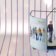
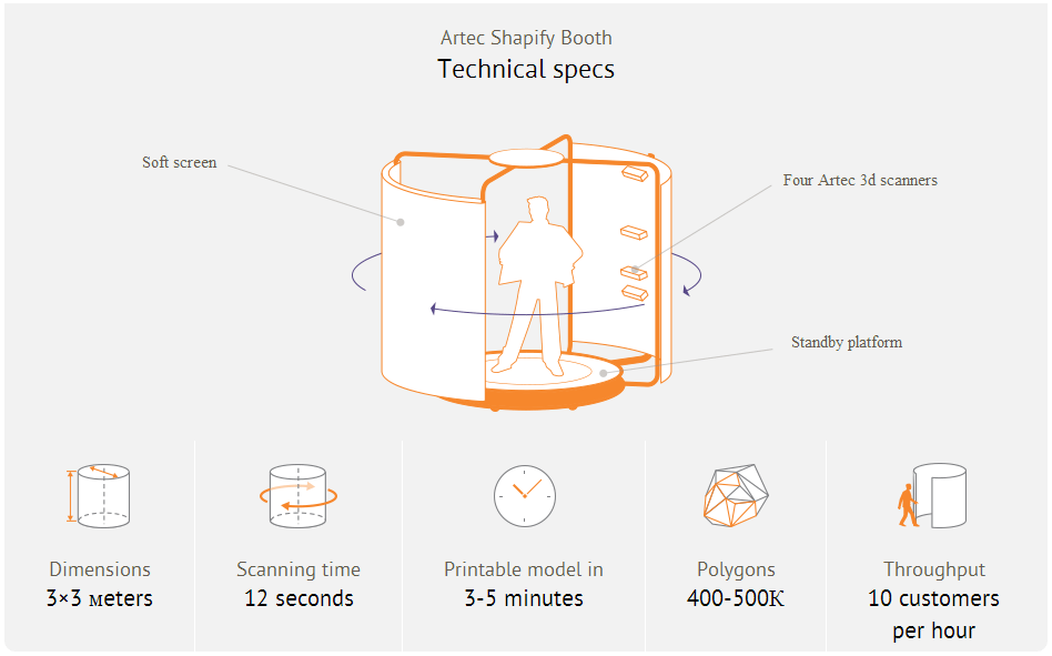
The Artec scanning booth, equipped with wide-view, high-resolution 3D scanners and a rotation rig, takes just 12 seconds to scan a person. The Artec algorithms automatically fuse 700 captured surfaces into a detailed printable file. This digital model is then sent to the Asda 3D printing centre to be made into an 8″ mini-statue in full colour which can be collected from the store just one week later. Asda’s unique 3D printing technologies allows the processing of a huge volume of high quality figurines at a time, while the prints costs just £60.

Asda first introduced 3D scanning and 3D printing customer’s figurines six months ago, using Artec handheld scanners. Driven by the immediate success of the venture and Asda’s vision to offer 3D technology to the public, Artec Group tailored its professional scanning equipment to spec and created the Shapify Booth, a high speed full body scanner that Asda is now making available to all.
Making 3D prints of all the family, customers can also come along to be scanned in their sports kit, wedding outfits, graduation robes or fancy dress, taking something totally new and personalised back home with them after their weekly shop.

If the trial of the Shapify technology at Trafford Park is successful the new booths will be rolled out to more stores in the Autumn.

Phil Stout, Asda Innovation Manager – Asda is fast becoming, not just a retailer but, a technology company and this innovation is another example of how we’re leading the way on in store consumer facing technology. We’ve been working with Artec technology for a while now and we’re delighted to be the first company in the world able to offer our customers this unique service.

Artyom Yukhin, Artec Group President and CEO – Over the last 5 years Artec has been providing 3D technologies to professionals in industries from space and automotive to medical and movie special effects, but we have always been looking for the chance to do something for the public. Asda’s backing and second to none customer understanding allowed us to create high speed scanners which are fun and easy for people to use.

About Asda Stores Ltd.

Founded in the 1960s in Yorkshire, Asda is one of Britain’s leading retailers. It has more than 180,000 dedicated Asda colleagues serving customers from 551 stores, including 32 Supercentres, 311 Superstores, 29 Asda Living stores, 179 Supermarkets, 25 depots and seven recycling centres across the UK. Its main office is in Leeds, Yorkshire and its George clothing division is in Lutterworth, Leicestershire. More than 18 million people shop at Asda stores every week and 98 per cent of UK homes are served by www.asda.com. Asda joined Walmart, the world’s number one retailer, in 1999.

About Artec Group

Artec Group is a manufacturer and developer of professional 3D hardware and software, headquartered in Luxembourg. Artec Group is a global market leader in 3D scanning solutions used by thousands of people all over the world.
Shapify, the technology for creating 3D printed figurines, was conceived and launched by Artec Group in 2013:www.shapify.me
For more information about Artec Group, visit www.artec-group.com.

Contacts:
Artec Group : press@artec-group.com

Google's Project Tango 3D Capture Device

Mantis Vision’s MV4D Tapped As Core 3D Capture Tech Behind Google’s Project Tango Tablets

Mantis Vision, a developer of some of the world’s most advanced 3D enabling technologies, today confirmed that its MV4D technology platform will serve as the core 3D engine behind Google’s Project Tango. Mantis Vision provides the 3D sensing platform, consisting of flash projector hardware components and Mantis Vision’s core MV4D technology which includes structured light-based depth sensing algorithms.

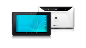
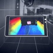
Project Tango Mantis Vision-Tablet_whiteGoogle’s new seven-inch tablet is the first mobile device released that will access the MV4D platform to easily capture, enrich and deliver quality 3D data at scale allowing Google developers to quickly build consumer and professional applications on top of the MV4D platform.

“3D represents a major paradigm shift for mobile. We haven’t seen a change this significant since the introduction of the camera-phone. MV4D allows developers to deliver 3D-enabled mobile devices and capabilities to the world,” said Amihai Loven, CEO, Mantis Vision. “This partnership with Google offers Mantis Vision the flexibility to expand quickly and strategically. It will fuel adoption and engagement directly with consumer audiences worldwide. Together, we are bringing 3D to the masses.”

MV4D is Mantis Vision’s highly-scalable 3D capture and processing platform that allows developers to integrate Mantis’ technology into new and existing applications with ease, to drive user-generated 3D content creation throughout the mobile ecosystem. MV4D’s combination of field-proven 3D imaging hardware and software and a soon-to-be released software development kit (SDK) will ultimately serve as the backbone of 3D-enabled mobile and tablet devices.

“We are excited about working with partners, such as Mantis Vision, as we push forward the hardware and software technologies for 3D sensing and motion tracking on mobile devices,” said Johnny Lee, Technical Product Lead at Google.

Since its inception, Mantis Vision has been dedicated to bringing professional-grade 3D technology to the masses. The company’s technology will be a key component of both professional and consumer level devices and applications across a wide customer base of leading mobile technology companies, application developers and device manufacturers. Because the MV4D platform and SDK is fully scalable, it is already being planned for use in more powerful, diverse range of products in the future.

Learn more about the project here

en-INTL-L-Kinect-for-Windows-Commercial-74Z-00001-mnco mocap 3d scanning

Microsoft Kinect for Windows v2: Affordable MoCap and 3D Scanning Solution

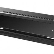
Amid the volley of announcements from Microsoft’s Build conference, is word that the new Kinect for Windows has a near-future release timeframe for both the hardware and its SDK. The desktop version of Microsoft’s do-all sensor will be available to the public this summer, as will its development framework. Perhaps more importantly, once they’re done, developers can publish their creations to the Windows Store; meaning, there’ll probably be more Kinect applications for Windows in one place than ever before. As Redmond tells it, this self-publishing will happen “later this summer.” Next summer, Microsoft is adding support for one of gaming’s most pervasive dev toolkits to Kinect for Windows: the Unity engine — tools developers already know the strengths and weaknesses of, which should bolster the app selection even further. Given that the Xbox One will see Unity support this year, this could mean that cross-platform apps and games are a distinct possibility.

With the specs of Kinect for Windows V2, the 3D scanning and imaging industries may be in for a game-changer. Indie film and game developers will hopefully be able to take advantage of its features as an affordable motion capture (mocap) solution.

Kinect motion capture guru and programmer, Jasper Brekelmans, has been playing with the second release of the Kinect for quite some time and has been posting some impressive results. You can stay on top of everything he is doing on his personal site http://www.brekel.com/.

You can pre-order your Kinect for Windows V2 today for $199 from the Microsoft Store.

hardware-independent-3d-laser-scanning-large-1152x648

Autodesk Announces ReCap Connect Partnership Program

With its new ReCap Connect Partnership Program, Autodesk will open up Autodesk ReCap – its reality capture platform – to third party developers and partners, allowing them to extend ReCap’s functionality.

“Autodesk has a long history of opening our platforms to support innovation and extension,” said Robert Shear, senior director, Reality Solutions, Autodesk. “With the ReCap Connect Partnership Program, we’ll be allowing a talented pool of partners to expand what our reality capture software can do. As a result, customers will have even more ways to start their designs with accurate dimensions and full photo-quality context rather than a blank screen.”

There are many ways for partners to connect to the ReCap pipeline, which encompasses both laser-based and photo-based workflows.  Partners can write their own import plug-in to bring structured point cloud data into ReCap and ReCap Pro using the Capture Codec Kit that is available as part of the new ReCap desktop version. DotProduct – a maker of handheld, self-contained 3D scanners – is the first partner to take advantage of this capability.

“Autodesk’s ReCap Connect program will enable a 50x data transfer performance boost for DotProduct customers — real time 3D workflows on tablets just got a whole lot faster. Our lean color point clouds will feed reality capture pipelines without eating precious schedule and bandwidth.” Tom Greaves, Vice President, Sales and Marketing, DotProduct LLC.

Alternately, partners can take advantage of the new Embedded ReCap OEM program to send Reality Capture Scan (RCS) data exports from their point cloud processing software directly to Autodesk design products, which all support this new point cloud engine, or to ReCap and ReCap Pro. The first signed partners in the Embedded ReCap OEM program are: Faro, for their Faro Scenesoftware; Z+F for their LaserControl software; CSA for their PanoMap software, LFM for their LFM software products; and Kubit for their VirtuSurv software.  All these partners’ software will feature this RCS export in their coming releases.

“Partnering with Autodesk and participating in the ReCap Connect program helps FARO to ensure a fluent workflow for customers who work with Autodesk products. Making 3D documentation and the use of the captured reality as easy as possible is one of FARO’s foremost goals when developing our products. Therefore, integrating with Autodesk products suits very well to our overall product strategy.” – Oliver Bürkler, Senior Product Manager, 3D Documentation Software & Innovation, FARO

As a third option, partners can build their own application on top of the Autodesk photo-to-3D cloud service by using the ReCap Photo Web API. More than 10 companies – serving markets ranging from medical and civil engineering, to video games and Unmanned Aerial Vehicles (UAVs) – have started developing specific applications that leverage this capability, or have started integrating this capability right into their existing apps. Some of the first partners to use the ReCap Photo Web API include Soundfit, SkyCatch and Twnkls.

“Autodesk’s cloud based ReCap is an important part of the SoundFit’s 3D SugarCube Scanning Service.  Autodesk’s ReCap service has enabled SoundFit to keep the per scan cost of its service very low, opening new markets, such as scans for hearing aids, custom fit communications headsets, musicians monitors and industrial hearing protection. ReCap allows SoundFit to export 3D models in a wide variety of popular 3D formats, so SoundFit customers and manufacturers can import them into Autodesk CAD packages from AutoCAD to 123D Design, or send them directly to any 3D printer or 3D printing service bureau.” – Ben Simon-Thomas, CEO & Co-Founder

For more information about the ReCap Connect Partnership Program, contact Dominique Pouliquen at Email Contact.

Additional Partner Supporting Quotes

“ReCap Connect gives our PointSense and PhoToPlan users smart and fully integrated access to powerful ReCap utilities directly within their familiar AutoCAD design environments. The result is a more simple and efficient overall workflow. ReCap Photo 360 image calibration eliminates the slowest part of a kubit user’s design process resulting in significant time savings per project.” – Matthias Koksch, CEO, kubit

“ReCap, integrated with CSA’s PanoMap Server, provides a powerful functionality to transfer laser scan point cloud data from large-scale 3D laser scan databases to Autodesk products.  Using the interface, the user can select any plant area by a variety of selection criteria and transfer the laser scan points to the design environment in which they are working. The laser scan 3D database of the plant can have thousands of laser scans.” – Amadeus Burger, President, CSA Laser Scanning

“Autodesk’s industry leading Recap photogrammetry technology will be instrumental in introducing BuildIT’s 3D Metrology solution to a broader audience by significantly reducing data capture complexity and cost.” – Vito Marone, Director Sales & Marketing, BuildIT Software & Solutions

“I am very pleased with the ReCap Photo API performance and its usefulness in fulfilling our 3D personalization needs. I believe the ReCap Photo API is the only product that is available in the market today that meets our needs.” – Dr. Masuma, PhD., Founder of iCrea8


Angela Costa Simoes

Senior PR Manager

DIRECT  +1 415 547 2388

MOBILE  +1 415 302 2934

@ASimoes76

Autodesk, Inc.

The Landmark @ One Market, 5th Floor

San Francisco, CA 94105

www.autodesk.com

RIEGL_Software_RiALITY_Screen-5d

Introducing the World’s First App for LiDAR data visualization on the iPad: RiALITY

RIEGL proudly announces its new iPad point cloud viewer: RiALITY, now available for free in the iTunes App Store.

This new, innovative App, the first of its kind, allows users to experience LiDAR data in a completely new environment. It also allows easier LiDAR data demonstrations through the use of an iPad.

RIEGL’s RiALITY App enables users to visualize and navigate through point clouds acquired with RIEGL laser scanners. As an example, users are able to explore a dataset of the beautiful Rosenburg Castle in Austria. RIEGL scans can also be imported from RIEGL’s RiSCAN PRO software into the App, as well.

“We’re pleased to present a new way of visualizing point clouds. RiALITY delivers this new technology by providing Augmented Reality technology in an easy-to-use app. Now you can easily send your client a 3D point cloud that they can visualize on their iPad, for free.” said Ananda Fowler, RIEGL’s manager of terrestrial laser scanning software.

RiALITY features true color point clouds and 3D navigation. In a breakthrough technological development, the app features an Augmented Reality Mode. The Augmented Reality Mode allows point clouds to be virtually projected into the real world.

Dive into the point cloud!

Find out more at www.riegl.com/app.

LiDAR for Visual Effects - Rebirth

Krakatoa Creates CG Visual Effects from LIDAR Scans for Short Film “Rebirth”

Film director and cinematographer Patryk Kizny – along with his talented team at LookyCreative – put together the 2010 short film “The Chapel” using motion controlled HDR time-lapse to achieve an interesting, hyper-real aesthetic. Enthusiastically received when released online, the three-minute piece pays tribute to a beautifully decaying church in a small Polish village built in the late 1700s. Though widely lauded, “The Chapel” felt incomplete to Kizny, so in fall of 2011, he began production on “Rebirth” to refine and add dimension to his initial story.

LiDAR for Visual Effects - Rebirth

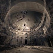
Exploring the same church, “Rebirth” comprises three separate scenes created using different visual techniques. Contemplative, philosophical narration and a custom orchestral soundtrack composed by Kizny’s collaborator, Mateusz Zdziebko, help guide the flow and overall aspirational tone of the film, which runs approximately 12 minutes. The first scene features a point cloud representation of the chapel with various pieces and cross-sections of the building appearing, changing and shifting to the music. Based on LIDAR scans taken of the chapel for this project, Kizny generated the point clouds with Thinkbox Software’s volumetric particle renderer, Krakatoa, in Autodesk 3ds Max.

LiDAR for VFX - Rebirth

“About a year after I shot ”The Chapel,” I returned to the location and happened to get involved in heritage preservation efforts,” Kizny explained. “At the time, laser scanning was used for things like archiving, set modeling and support for integrating VFX in post production, but I hadn’t seen any films visualizing point clouds themselves, so that’s what I decided to do.”

EKG Baukultur an Austrian/German company that specializes in digital heritage documentation and laser scanning, scanned the entire building in about a day from 25 different scanning positions. The collected data was then registered and processed – creating a dataset of about 500 million points. Roughly half of the collected data was used to create the visualizations.

3D Laser Scanning for Visual Effects - Rebirth

Data processing was done in multiple stages using various software packages. Initially, the EKG Baukultur team registered the separate scans together in a common coordinates space using FARO Scene software. Using .PTS format, the data was then re-imported into Alice Labs Studio Clouds (acquired by Autodesk in 2011) for clean up. Kizny manually removed any tripods with cameras, people, checkerboards and balls that had been used to reference scans. Then, the data was processed in Geomagic Studio to reduce noise, fill holes and uniformly downsample selected areas of the dataset. Later, the data was exported back to the .PTS ASCII format with the help of MeshLab and processed using custom Python scripting so that it could be ingested using the Krakatoa importer. Lacking a visual effects background, Kizny initially tested a number of tools to find the best way to visualize point cloud data in a cinematic way with varying and largely disappointing results. Six months of extensive R&D led Kizny to Krakatoa, a tool that was astonishingly fast and a fraction of the price of similar software specifically designed for CAD/CAM applications.

“I had a very basic understanding of 3ds Max, and the Krakatoa environment was new to me. Once I began to figure out Krakatoa, it all clicked and the software proved amazing throughout each step of the process,” he said.

Even with mixing the depth of field and motion blur functions in Krakatoa, Kizny was able to keep his render time to roughly five to ten minutes per frame, even while rendering 200 million points in 2K, by using smaller apertures and camera passes from a higher distance.

“Krakatoa is an amazing manipulation toolkit for processing point cloud data, not only for what I’m doing here but also for recoloring, increasing density, projecting textures and relighting point clouds. I have tried virtually all major point cloud processing software, but Krakatoa saved my life on this project,” Kizny noted.

In addition to using Krakatoa to visualize all the CG components of “Rebirth” as well as render point clouds, Kizny also employed the software for advanced color manipulation. With two subsets of data – a master with good color representation and a target that lacked color information – Kizny used a Magma flow modifier and a comprehensive set of nodes to cast and spatially interpolate the color data from the master subset onto the target subset so that they blended seamlessly in the final dataset. Magma modifiers were also used for the color correction of the entire dataset prior to rendering, which allowed Kizny greater flexibility compared to trying to color correct the rendering itself. Using Krakatoa with Magma modifiers also provided Kizny with a comprehensive set of built-in nodes and scripting access.

3D Laser Scanning for Visual Effects - Rebirth

The second scene of “Rebirth” is a time-lapse reminiscent of “The Chapel,” while the final scene shows live action footage of a dancer. Footage for each scene was captured using Canon DSLR cameras, a RED ONE camera and DitoGear motion control equipment. Between the second and third scene, a short transition visualizes the church collapsing, which was created using 3ds Max Particle Flow with help of Thinkbox Ember, a field manipulation toolkit, and Thinkbox Stoke, a particle reflow tool.

“In the transition, I’m trying to collapse a 200 million-point data cloud into smoke, then create the silhouette of a dancer as a light point from the ashes,” shared Kizny. “Even though it’s a short scene, I’m making use of a lot of technology. It’s not only rendering this point cloud data set again; it’s also collapsing it. I’m using the software in an atypical way, and Thinkbox has been incredibly helpful in troubleshooting the workflow so I could establish a solid pipeline.”

Collapsing the church proved to be a challenge for Kizny. Traditionally, when creating digital explosions, VFX artists are blowing up a solid, rigid object. Not only did Kizny need to collapse a point cloud – a daunting task in of itself – but he also had to do so in the hyper-realistic aesthetic he’d established, and in a way that would be both ethereal and physically believable. Using 3ds Max Particle Flow as a simulation environment, Kizny was able to generate a comprehensive vector field of high resolution that was more efficient and precisely controlled with Ember. Ember was also used to animate two angels appearing from the dust and smoke along with the dancer silhouette. The initial dataset of each of angels was pushed through a specific vector noise field that produced a smoke-like dissolve and then reversed thanks to retiming features in Krakatoa, Ember and Stoke, which was also used to add density.

3D Laser Scanning for Visual Effects - Rebirth

“To create the smoke on the floor, I decided to go all the way with Thinkbox tools,” Kizny said. “All the smoke you see was created using Ember vector fields and simulated with Stoke. It was good and damn fast.”

Another obstacle was figuring out how to animate the dancer in the point clouds. Six cameras recorded a live performer with markerless motion capture tracking done using iPi Motion Capture Studio package. The data obtained from the dancer was then ported onto a virtual, rigged model in 3ds Max and used to emit particles for a Particle Flow simulation. Ember vector fields were used for all the smoke-like circulations and then everything was integrated and rendered using Thinkbox’s Deadline, a render management system, and Krakatoa – almost 900 frames and 3 TB of data caches only for particles. Deadline was also used to distribute high volume renders and allocate resources across Kizny’s render farm.

Though an innovative display of digitally artistry, “Rebirth” is also a preservation tool. Interest generated from “The Chapel” and continued with “Rebirth” has enticed a Polish foundation to begin restoration efforts on the run-down building. Additionally, the LIDAR scans of the chapel will be donated to CyArk, a non-profit dedicated to the digital preservation of cultural heritage sites, and made widely available online.

The film is currently securing funding to complete postproduction. Support the campaign and learn more about the project at the IndieGoGo campaign homepage at http://bit.ly/support-rebirth. For updates on the film’s progress, visit http://rebirth-film.com/.

About Thinkbox Software
Thinkbox Software provides creative solutions for visual artists in entertainment, engineering and design. Developer of high-volume particle renderer Krakatoa and render farm management software Deadline, the team of Thinkbox Software solves difficult production problems with intuitive, well-designed solutions and remarkable support. We create tools that help artists manage their jobs and empower them to create worlds and imagine new realities. Thinkbox was founded in 2010 by Chris Bond, founder of Frantic Films. http://www.thinkboxsoftware.com

Leica_CloudWorx_for_AutoCAD

Leica Geosystems announces updates for its point cloud software applications

Leica Geosystems announces a major set of updates for its point cloud software applications within its flagship Leica Cyclone and Leica CloudWorx families. These updates save a significant time in the office per day and make it more convenient to work with rich, as-built point cloud data. This is the company’s largest set of point cloud software releases to date.

“What we’re seeing in the market is that our customers are using laser scanning in an increasing variety of scenarios and under more demanding circumstances, so they need more options for working with point cloud data and they need to do their work even faster,” states Chris Thewalt, VP of Scanning Software.  “Overall, we continue to see strong growth of 3D laser scanning/High-Definition Surveying (HDS) with a corresponding expansion and diversification of our user community’s needs. In response, we’ve been investing heavily in a number of our standalone Cyclone and our plug-in CloudWorx point cloud software applications. This large set of releases reflects that ongoing investment.”

Leica Cyclone and Leica CloudWorx families

• More flexible licensing lets users easily move licenses between the field and office and on-or-off a network.
• Users on customer support can implement license upgrades on their own at any time
• Rentals are now available for as short as one week for most products; discounts are available for extended rental periods

Leica CloudWorx for AutoCAD 5.0

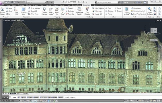
• Plug-in for AutoCAD saves hours in the office for working with 3D point clouds in AutoCAD for both experienced users and users new to working in 3D
• Easier X,Y,Z coordinate system setup and faster navigation to desired views; faster creation of 2D drawings; faster ground surface and TIN creation; and, faster selection of high, low and ground points

Leica CloudWorx for 3ds Max 2.0

• New Leica CloudWorx plug-in family member (replaces Leica CloudWorx-VR)
• Eliminates prior need to export from Cyclone and import to Leica CloudWorx-VR; users now enjoy direct data access to Cyclone files
• Adds rich set of standard CloudWorx plug-in tools for working more efficiently with point clouds in 3ds Max

Leica CloudWorx for PDMS 1.3

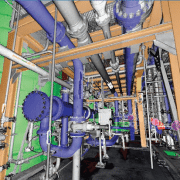
• Plug-in for PDMS adds valuable option of importing plant models from PDMS directly into Leica Cyclone and exporting models created from point clouds in Cyclone directly into PDMS
• Avoids prior need to import/export models into/from PDMS and Cyclone via AutoCAD or MicroStation
• Supports direct import of PDMS models into popular Leica TruView software

Leica_CloudWorx_for_AutoCAD

LFM Server

LFM Server 4.2 – Introducing Key New Features

As 3D laser scanning has become easier and more affordable it has become the technology of choice for ‘as-is’ data capture. LFM Server™ enables users to maximize the value of the rich information that laser scanning generates.

LFM Server is the most advanced solution available for accessing pre-registered laser scan data and working with it directly in 3D CAD systems. It is simple to use and offers unrivalled performance and functionality.

There are many different 3D laser scanners and 3D CAD systems in use today. LFM Server has been developed to provide users with maximum freedom of choice of both scanning and design systems. It can read unstructured data from various scanner types; not only terrestrial laser scanners but also hand-held, mobile or aerial scanners.

Designed to work with data from even the highest-resolution scanner, LFM Server enables users to work with datasets of unlimited size and exploit photorealistic, 360° BubbleViews™.

Business Benefits

  • Open on the input
    LFM Server can read a wide variety of 3D data capture formats
  • Open on the output
    LFM Server interfaces seamlessly with all leading 3D CAD systems
  • Unlimited Datasets
    InfiniteCore™ technology enables project datasets of unlimited size to be readily created and accessed
  • Increased Productivity
    The intuitive 360° BubbleView makes it easy to verify clashes, review laser scan data, or simply become familiar with the site
  • Clash-free Design
    Accurate, detailed ‘as-is’ information minimizes the business risks of revamp projects
  • Business Flexibility
    Import scans from a wide variety of scanner types and data formats into a single dataset

For more information about LFM Server 4.2’s great new features, contact us or read more here.