Autodesk Expands Power of AutoCAD 2011 with New Point Cloud Support

SAN RAFAEL, Calif.–(BUSINESS WIRE)–Autodesk, Inc. (NASDAQ:ADSK) announced the availability of the 2011 AutoCAD software products, including AutoCAD 2011 software, a leading 2D and 3D design and documentation platform, and AutoCAD LT 2011 software for professional 2D drafting and detailing. The latest releases of AutoCAD deliver powerful new features — such as new tools for surface modeling and transparency for objects and layers — that can help designers explore their ideas and maximize productivity. The 2011 AutoCAD products are Microsoft Windows 7 certified and are compatible with and supported on Windows 7 Home Premium, Professional, Enterprise, and Ultimate as well as Windows Vista and Windows XP operating systems.

“We have also implemented many of the top features requested by Autodesk User Group International (AUGI) members and focused on providing new tools that are quick to learn but can have a big impact in everyday work.”

“In the 2011 releases we have continued to invest in increasing drafting productivity and have added a strong set of new 3D modeling features for conceptual design that will help millions of AutoCAD users worldwide take their designs further,” said Guri Stark, vice president, AutoCAD and Platform Products. “We have also implemented many of the top features requested by Autodesk User Group International (AUGI) members and focused on providing new tools that are quick to learn but can have a big impact in everyday work.”

AutoCAD 2011 gives designers more advanced conceptual design tools as well as increased flexibility and control when designing in 3D:

  • New surface modeling tools enable users to easily create smooth surfaces and surface transitions, while associativity maintains relationships between all of the objects.
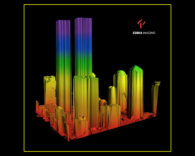
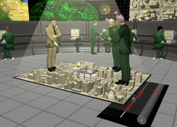
  • Point cloud support for up to two billion points enables users to quickly visualize scanned objects directly within the modeling workspace.
  • Inferred constraints enable designers to define constraints as they draw.
  • Hatch command enhancements bring improved drafting efficiency, while new gradient hatch patterns enable users to add more colors and shading to drawings.
  • TimeSaver tools, previously available only to customers on Autodesk Subscription, are now available to all AutoCAD users.

AutoCAD LT 2011 builds on its reputation for productivity with new commands that make everyday tasks more efficient. In addition to the hatch command enhancements and TimeSaver Tools found in AutoCAD 2011, AutoCAD LT 2011 adds new tools that give users additional options for controlling the appearance of drawings:

  • Transparency for objects and layers provides new options for managing the appearance of drawings and communicating design intent.
  • New multifunctional polyline grips make editing polylines significantly faster and easier.
  • The ability to create or select similar objects based on the properties of existing objects helps users save time when drawing and editing geometry.

Industry Solutions for the AutoCAD 2011 Products

The updated AutoCAD 2011 software portfolio includes the following industry-specific applications built on the AutoCAD platform:

  • AutoCAD Architecture 2011 software for efficient architectural drafting and documentation has new geometric and dimensional constraints and renovation tools to help accelerate design.
  • AutoCAD Electrical 2011 software helps electrical controls designers to quickly create control system designs and easily access extensive catalog information for large electrical controls projects.
  • AutoCAD Mechanical 2011 software’s streamlined design environment gives users vastly improved access to power dimensioning functionality, which automatically aligns part dimensions with the rest of the drawing properties, without ever opening a dialog box.
  • AutoCAD MEP 2011 software provides greater drafting productivity for mechanical, electrical and plumbing (MEP) designers and drafters and has new features for creating and storing AutoCAD block names, sloped piping and parallel conduit routing.

Availability

Product availability varies by country. Details and purchasing options are available at www.autodesk.com/purchaseoptions.

About Autodesk

Autodesk, Inc., is a world leader in 2D and 3D design, engineering and entertainment software for the manufacturing, building and construction, and media and entertainment markets. Since its introduction of AutoCAD software in 1982, Autodesk continues to develop the broadest portfolio of state-of-the-art software to help customers experience their ideas digitally before they are built. Fortune 100 companies — as well as the last 15 Academy Award winners for Best Visual Effects — use Autodesk software tools to design, visualize and simulate their ideas to save time and money, enhance quality and foster innovation for competitive advantage. For additional information about Autodesk, visit www.autodesk.com.

Autodesk, AutoCAD and AutoCAD LT are registered trademarks or trademarks of Autodesk, Inc., and/or its subsidiaries and/or affiliates in the USA and/or other countries. Academy Award is a registered trademark of the Academy of Motion Picture Arts and Sciences. All other brand names, product names or trademarks belong to their respective holders. Autodesk reserves the right to alter product and services offerings, and specifications and pricing at any time without notice, and is not responsible for typographical or graphical errors that may appear in this document.

© 2010 Autodesk, Inc. All rights reserved.

3D Visualization Comes Alive [Holograms]

Zebra Imaging Produces Printable 3D HologramsThree-dimensional space is a geometric model of the physical universe in which we live, work and are now entertained. Television manufacturers are quickly working to release the 3D-capable broadcasts that cable and satellite providers are already offering. For example, the 2010 Masters will be broadcast live in 3D on CBS, April 8-11. 3D movies used to be a rarity, but are now found weekly in theaters across the nation.
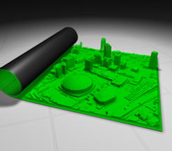
Physical 3D models have been used for decades to visualize City improvements in need of public approval and to help architects portray their ideas to the owner. Topographic contour maps have been used to visualize ground terrain in a two-dimensional environment for drainage studies, military strategy planning, city planning, etc. These models are often costly and take too long to construct.

Printed renderings are more easy and cost-effective to produce, but they lack the interactiveness of even the physical models.

The recent developments and adoption of Building Information Models (BIM) and intelligent 3D models have enabled architects and engineers to reach beyond just building a “pretty picture”. These “intelligent” models serve as a collaboration tool for designers working on different aspects of the project to visualize their designs and avoid any clashes during construction. Once the project is complete, this data can be used for detailed asset/facility life-cycle management.

The industry is now relying more on the virtual 3D models for design and construction and less on the typical 2D plans. However, we are still faced with the dilemma of having a working document that we can physically touch that represents the latest design. If only there was a way to have the best of both worlds – a 3D model on a 2D printed plan.

A while back I stumbled across Zebra Imaging through Twitter and after spending a day at their facility in Austin, Texas, I believe our industry is about to change. They produce full-color printed holographic images that can be used for numerous visualization applications including military planning project and concept demonstrations for investors.

3D is now a standard output for most CAD systems, and is commonly used for viewing terrain data and built environments. ZEBRA Imaging offers a product that allows you to view this data from more than one angle, without having to redraw the images on a computer screen. ZEBRA Imaging provides fairly large – 600mm by 800mm – flat media holograms. They are portable and can be created using a number of data sources; most importantly, they don’t require special tools (e.g. glasses or scopes) for viewing.

The holograms are used in a variety of ways, including military visualizations, project presentations and concept demonstrations for investors.

Monochrome view of New Orleans showing the Superdome.


From ZEBRA Imaging literature:

  • 3-D perspectives are visible horizontally and vertically; one can look over and under the image and from side to side without glasses or goggles
  • Wide angle of view – horizontal viewing is over 95 degrees, allowing many people to walk around and view an image simultaneously
  • Allows for unlimited size while maintaining the integrity of the image
  • Images are projected several feet in front of or behind the hologram and appear to be floating in air
  • Compact and portable – images are flat or flexible plastic panels that can be stored and shipped easily, taking up very little space
  • Any 3-D volumetric data set from any source may be used

ZEBRA’s capabilities also include the ability to produce holograms that change depending upon the viewer’s angle. This is beneficial when attempting to depict varying levels of a building, terrain, etc. It is also helpful when trying to portray a particular image before and after an event. For example, Zebra created 3D visual of the Lower Manhattan skyline before and after 9-11. From one angle, a view of the Twin Towers before the disaster can be seen and from another, the rubble in the aftermath.

Before 9-11. (Click for larger image)
After 9-11. (Click for larger image)

The four images below were used at the GEOINT Symposium to show the same corner at four different time periods. Each time the corner is viewed, it shows a different aspect of the structure.

(Click for larger image)
ZEBRA Imaging showed this example of generals looking at an urban area. The entire image is a color hologram – including the generals, the people in the background, etc.

Viewing a Zebra Imaging hologram is a viewing experience that is impossible to appreciate with the 2D limitations of a computer screen. The videos below give you an opportunity to understand how the real-world Zebra holograms appear through the lens of a 2D video camera.

Overview Video
A 2 minute overview showing a wide array of sample 3D Zebra holographic images
Windows Media – 5mbQuicktime – 24mb

Monochrome
A 15 second video that shows several monochrome samples (includes holograms not found in the Overview video)
Windows Media – 560kQuicktime – 3mb

Architecture

15 second video that shows several architectural holographic image samples
Windows Media – 640kQuicktime – 4mb

Automotive & Manufacturing

A 57 second video that shows automotive and other manufacturing 3D Zebra holographic images. Contains similar footage as the overview with a few more examples
Windows Media – 2.3mbQuicktime – 15mb

Industrial Design
30 second video containing several samples of industrial design holographic images
Windows Media – 1.2mbQuicktime – 5.4mb

This image shows an interesting real-world application for the Ford Motor Company.

The first movie shows an interesting real-world application for the Ford Motor Company. This image shows the interior layout of a specific car.

A map is a model of reality that allows you to see, understand and analyze geography. ZEBRA Imaging’s offerings extend this model in a most interesting and utilitarian way.

Michael Klug, CTO of Zebra Imaging discusses the technology at Autodesk University 2009:

IBM Visualizes a “Smarter Planet” using 3D Laser Scanning Technology [LiDAR]

HOUSTON, TX March 18, 2010 Coign Asset Metrics & Technologies (CoignAMT), at the direction of Zoo Film Productions of Hollywood, CA, has helped produce IBM’s first globally released television commercial created entirely from Light Detection and Ranging (LiDAR) 3D point cloud data.

CoignAMT used the HDS6100 phase-based laser scanner from Leica Geosystems to create scenes of cars on a freeway, patients in a hospital, electricity grids and much more. The 30-second LiDAR-based commercial is a key part of IBM’s Smarter Planet initiative to portray that data is all around; and that by changing the way the world thinks, companies can maximize the use of data to lower their costs and reduce environmental impact.

Travis Reinke, business sector manager for CoignAMT, says, “Coincidentally, IBM’s perspective is a core part of CoignAMT’s business practice. We help our clients see the long-term value of the data they currently have by using the latest technology, such as 3D laser scanning, to quickly gather an immense amount of data to support their existing “intelligent” systems.”

The Zoo Film Productions crew spent a week in Houston, TX with CoignAMT personnel capturing laser scan data of transmission lines and over 16 blocks of downtown Houston streetscape and surounding buildings. CoignAMT then merged the point cloud data gathered in downtown with 6 square miles of low-altitude helicopter-based LiDAR provided by Aerotec LLC out of Birmingham, AL. Zoo Film Productions crews also created numerous scenes of hospital activities as well as automobiles with and without drivers that CoignAMT scanned individually for use in the commercial.

Reinke continues, “We were honored to be part of this innovative project given the direct correlation between the services CoignAMT provides and IBM’s Smarter Planet initiatives. Using the latest laser scanning technology to visually portray the importance of the data surrounding us was an unforeseen irony. I would never have imagined that we would be using this technology to scan people and cars, objects that are often considered ‘noise’ on a typical inventory project.”

View IBM “Data Anthem” at 848×480: http://www.glossyinc.com/zoo/ibmdataanthem.html
Full credits and a selection of stills: http://www.glossyinc.com/ibmdacred.html
Follow CoignAMT on Twitter: http://www.twitter.com/CoignAMT
Follow Travis Reinke on Twitter: http://www.twitter.com/HDLS

YouTube: http://www.youtube.com/watch?v=3cj6VtYpBI4

# # #

About Coign Asset Metrics & Technologies LLC:
Coign Asset Metrics & Technologies, LLC (CoignAMT) is a HUBZone qualified, SBA certified, small business that provides a full range of asset management life cycle services and specialized technologies, including high definition laser scanning (HDLS). Its mission is to strengthen public and private sector organizations by aligning their assets and operational practices with their strategic initiatives. CoignAMT is headquartered in the Pittsburgh, PA area, with regional offices located in Colorado Springs, CO, and Houston, TX. Clients include federal, state, and local governments, as well as private sector customers in the construction, energy, transportation, manufacturing, and security industries.

Boeing Launches Compact 3-D Imaging Camera

ALBUQUERQUE, N.M., March 8, 2010 — The Boeing Company [NYSE: BA] today announced it has begun offering a new, compact, energy-efficient camera that provides three-dimensional images for military and commercial applications.

Boeing Directed Energy Systems and wholly owned Boeing subsidiary Spectrolab have jointly developed the camera using their own research and development funding, and successfully tested it over the past two years by attaching it to mobile ground platforms and a Boeing AH-6 Little Bird helicopter. Equipped with advanced sensors that were developed by the Massachusetts Institute of Technology’s Lincoln Laboratory and transferred to Boeing under a teaming arrangement, the cube-shaped camera is one-third the size and uses one-tenth the power of most comparable 3-D imaging cameras.

“Our three-dimensional camera fits a lot of capability into a small package,” said Nasser Karam, vice president of Advanced Technology Products at Spectrolab. “Its compact design and modest power needs will allow it to be deployed on a wide range of platforms, including unmanned aerial and ground vehicles that don’t have much room or power to spare.”

The camera, which Boeing can customize for each customer, has many potential uses, including mapping terrain, tracking targets and seeing through foliage. To create a 3-D image, the camera fires a short pulse of laser light, then measures the pulse’s flight time to determine how far away each part of the camera’s field of view is.

“The camera combines cutting-edge sensor technology with Boeing’s advanced pointing and tracking solutions and real-time processing to provide our customers with highly integrated 3-D imaging payloads for ground, airborne or space-based applications,” said Joseph Paranto, Growth lead for Directed Energy Systems in Albuquerque.

Boeing is currently integrating the camera into compact 3-D imaging payloads on unmanned aerial vehicles and will be testing that capability this spring. The team will also add 3-D video capability to the camera soon to complement its existing still-image capability.

A unit of The Boeing Company, Boeing Defense, Space & Security is one of the world’s largest defense, space and security businesses specializing in innovative and capabilities-driven customer solutions, and the world’s largest and most versatile manufacturer of military aircraft. Headquartered in St. Louis, Boeing Defense, Space & Security is a $34 billion business with 68,000 employees worldwide.

Source: http://boeing.mediaroom.com/index.php?s=43&item=1107

Bentley Announces Integration of Pointools

Bentley Announces Point Cloud Integration using PointoolsPresented by: Executives from Spar Point research, Pointools, and Bentley

Summary:On October 14, 2009, Bentley announced that it had signed a “Continuous Technology Transfer Agreement” to incorporate Pointools’ Vortex Engine in the Bentley Technology Platform to enable reuse of 3D laser scanned data. This webinar will include three different perspectives on this agreement. To see the future of 3D data integration and platform interoperability you have to attend this webinar.

What you can learn:

  • An overview by Spar Point Research of the impact that laser scanning technology is having on the design, construction, and management of industrial plant, BIM, and civil/transportation infrastructure assets
  • The importance of integrating this technology into the daily workflows of infrastructure professionals and the value users will realize from this integration
  • A brief demonstration by Pointools of the Vortex engine functionality including an explanation on why the Pointools’ technology is so fast and so capable of handling billions of point clouds at one time
  • Watch this eSeminar by chapter:
    These videos open directly into your media player.

    Resources:

    Autodesk Announces Integrated LiDAR Solution

    The Autodesk® Subscription Advantage Pack for AutoCAD® Civil 3D® 2010 provides new functionality for importing and visualizing point clouds and designing roundabouts, and powerful enhancements that can help streamline existing workflows in AutoCAD® Civil 3D® 2010 software. This pack also includes Autodesk® ImageModeler™ 2009 software.

    This Subscription Advantage Pack is available exclusively for Autodesk® Subscription customers through download in the Autodesk Subscription Center.

    Features and Benefits

    Point Clouds—Import and visualize large sets of point cloud data, such as 3D laser scanning/LiDAR data sets with millions of points, in AutoCAD Civil 3D 2010 with the Point Clouds feature. The point cloud feature enables you to:

    Import LiDAR data in LAS format and all point file formats supported by AutoCAD Civil 3D 2010

    • Visualize large point clouds in 3D
    • Stylize point data based on LAS classifications, RGB, elevation, and intensity
    • Filter point data by style
    • Snap to points within the point cloud using standard AutoCAD® software tools

    Some common uses of LiDAR data in AutoCAD Civil 3D 2010 may include using the point cloud data for site surveys, developing an understanding of the site context, and digitizing as-built features (for example, building footprints and curbs) for design projects.

    Autodesk and partners released the following webcast overview. The meat of the relevant information starts at about the 35 minute marker. http://www.aec-projects.com/seminars/022510/