


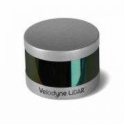
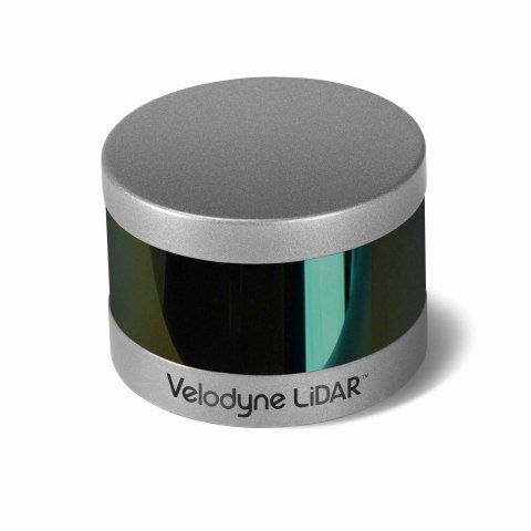
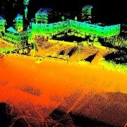
MORGAN HILL, Calif.–(BUSINESS WIRE)–Velodyne LiDAR Inc., the recognized global leader in Light, Detection and Ranging (LiDAR) technology, today unveiled its new Puck Hi-Res™ sensor, a version of the company’s groundbreaking LiDAR Puck that provides higher resolution in captured 3D images, which allows objects to be identified at greater distances. Puck Hi-Res is the third new LiDAR sensor released by the company this year, joining the standard VLP-16 Puck™ and the Puck LITE™.
“Not only does the Puck Hi-Res provide greater detail in longer ranges, but it retains all the functions of the original VLP-16 Puck that shook up these industries when it was introduced in September 2014.”
“Introducing a high-resolution LiDAR solution is essential to advancing any industry that leverages the capture of 3D images, from autonomous navigation to mapping to surveillance,” said Mike Jellen, President and COO, Velodyne LiDAR. “The Puck Hi-Res sensor will provide the most detailed 3D views possible from LiDAR, enabling widespread adoption of this technology while increasing safety and reliability.”
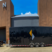
Expanding on Velodyne LiDAR’s groundbreaking VLP-16 Puck, a 16-channel, real-time 3D LiDAR sensor that weighs just 830 grams, Puck Hi-Res is used in applications that require greater resolution in the captured 3D image. Puck Hi-Res retains the VLP-16 Puck’s 360° horizontal field-of-view (FoV) and 100-meter range, but delivers a 20° vertical FoV for a tighter channel distribution – 1.33° between channels instead of 2.00° – to deliver greater details in the 3D image at longer ranges. This will enable the host system to not only detect, but also better discern, objects at these greater distances.
“Building on the VLP-16 Puck and the Puck LITE, the Puck Hi-Res was an intuitive next step for us, as the evolution of the various industries that rely on LiDAR showed the need for higher resolution 3D imaging,” said Wayne Seto, product line manager, Velodyne LiDAR. “Not only does the Puck Hi-Res provide greater detail in longer ranges, but it retains all the functions of the original VLP-16 Puck that shook up these industries when it was introduced in September 2014.”
“The 3D imaging market is expected to grow from $5.71B in 2015 to $15.15B in 2020, led by the development of autonomous shuttles for large campuses, airports, and basically anywhere there’s a need to safely move people and cargo,” said Dr. Rajender Thusu, Industry Principal for Sensors & Instruments, Frost & Sullivan. “We expect Velodyne LiDAR’s line of sensors to play a key role in this surge in autonomous vehicle development, as the company leads the way in partnerships with key industry drivers, along with the fact that sensors like the new Puck Hi-Res are substantially more sophisticated than competitive offerings and increasingly accessible to all industry players.”
Velodyne LiDAR is now accepting orders for Puck Hi-Res, with a lead-time of approximately eight weeks.
About Velodyne LiDAR
Founded in 1983 by David S. Hall, Velodyne Acoustics Inc. first disrupted the premium audio market through Hall’s patented invention of virtually distortion-less, servo-driven subwoofers. Hall subsequently leveraged his knowledge of robotics and 3D visualization systems to invent ground breaking sensor technology for self-driving cars and 3D mapping, introducing the HDL-64 Solid-State Hybrid LiDAR sensor in 2005. Since then, Velodyne LiDAR has emerged as the leading supplier of solid-state hybrid LiDAR sensor technology used in a variety of commercial applications including advanced automotive safety systems, autonomous driving, 3D mobile mapping, 3D aerial mapping and security. The compact, lightweight HDL-32E sensor is available for applications including UAVs, while the VLP-16 LiDAR Puck is a 16-channel LiDAR sensor that is both substantially smaller and dramatically less expensive than previous generation sensors. To read more about the technology, including white papers, visit http://www.velodynelidar.com.
Velodyne LiDAR
Laurel Nissen
lnissen@velodyne.com
or
Porter Novelli/Voce
Andrew Hussey
Andrew.hussey@porternovelli.com

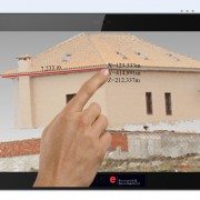
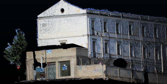
Leica Pegasus Backpack is a unique wearable reality capturing sensor platform combining cameras and Lidar profilers with the lightness of a carbon fiber chassis and a highly ergonomic design. The Pegasus:Backpack enables extensive and efficient indoor or outdoor documentation at a level of accuracy that is authoritative and professional. The Pegasus:Backpack is designed for rapid and regular reality capture – no longer is scanning registration needed for progressive scanning. The Pegasus:Backpack is just completely portable – enabling it to be checked in as luggage on a flight – simply fly-in, wear, collect, then fly-out. As part of the Pegasus platform, the Pegasus:Backpack is designed to act as a sensor platform with our standard external trigger and sync port outputs.
Map indoors, outdoors, underground, anywhere
Making progressive professional BIM documentation a reality with the Leica Pegasus:Backpack solution, synchronising imagery and point cloud data together, therefore assuring a complete documentation of a building for full life cycle management. By using SLAM (Simultaneous Localization and Mapping) technology and a high precision IMU, we ensure accurate positioning with GNSS outages – ensuring the best known position independent of how it is used.
With the Leica Pegasus:Backpack outdoor areas or underground infrastructures with limited access professional data collection is no longer limited . By capturing full 360 spherical view and Lidar together means you never forget an object or return to a project site – no matter where you are. A hardware light sensor ensures the operator that all images are usable while other functions are verifiable and adjustable over the operators tablet device.
Main features
Hardware features

Leica Pegasus:Backpack enables unimaginable applications for indoor and outdoor mapping combining visual images with the accuracy of a point cloud for professional documentation – in a wearable, ergonomic, and ultra light carbon fiber construction.
Software features
Software benefits
Source: Tech Crunch
As we reported earlier this year, Google is building a mobile device with 3D sensing capabilities — under the Project Tango moniker. But it’s not the only company looking to combine 3D sensing with mobility.
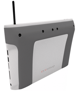
Spanish startup E-Capture R&D is building a tablet with 3D sensing capabilities that’s aiming to target the enterprise space — for example as a portable tool for surveyors, civil engineers, architects and the like — which is due to go on sale at the beginning of 2015.
The tablet, called EyesMap, will have two rear 13 megapixel cameras, along with a depth sensor and GPS to enable it to measure co-ordinates, surface and volumes of objects up to a distance of 70 to 80 meters in real-time.
So, for instance, it could be used to capture measurements of – or create a 3D model of — a bridge or a building from a distance. Or to model objects as small as insects so it could be used to 3D scan individual components by civil engineers, for instance.
Its makers claim it can build high-resolution models with HD realistic textures.
EyesMap uses photogrammetry to ensure accurate measurements and to build outdoor 3D models, but also has an RGBD sensor for indoor scanning.
 The tablet will apparently be able to scan an “advanced photogrammetric picture” with up to 4 million dots in around 2 minutes. It will also be able to capture 3D objects in motion. It’s using a blend of computer vision techniques, photogrammetry, visual odometer, “precision sensor fine tuning” and other image measuring techniques, say its makers.
E-Capture was founded back in April 2012 by a group of experienced surveyors and Pedro Ortiz-Coder, a researcher in the laser scanning and photogrammetry field. The business has been founder funded thus far, but has also received a public grant of €800,000 to help with development.
In terms of where EyesMap fits into the existing enterprise device market, Ortiz-Coder says it’s competing with multiple standalone instruments in the survey field — such as 3D scanners, telemeters, photogrammetry software and so on — but is bundling multiple functions into a single portable device.
“To [survey small objects], a short range laser scanner is required but, a short-range LS cannot capture big or far away objects. That’s why we thought to create a definitive instrument, which permits the user to scan small objects, indoors, buildings, big objects and do professional works with a portable device,” he tells TechCrunch.
“Moreover, there wasn’t in the market any instrument which can measure objects in motion accurately more than 3-4 meters. EyesMap can measure people, animals, objects in motion in real time with a high range distance.”
The tablet will run Windows and, on the hardware front, will have Intel’s 4th generation i7 processor and 16 GB of RAM. Pricing for the EyesMap slate has not yet been announced.
Another 3D mobility project we previously covered, called LazeeEye, was aiming to bring 3D sensing smarts to any smartphone via an add on device (using just RGBD sensing) — albeit that project fell a little short of its funding goal on Kickstarter.
Also in the news recently, Mantis Vision raising $12.5 million in funding from Qualcomm Ventures, Samsung and others for its mobile 3D capture engine that’s designed to work on handheld devices.
There’s no denying mobile 3D as a space is heating up for device makers, although it remains to be seen how slick the end-user applications end up being — and whether they can capture the imagination of mainstream mobile users or, as with E-Capture’s positioning, carve out an initial user base within niche industries.
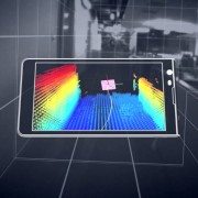
Mantis Vision, a developer of some of the world’s most advanced 3D enabling technologies, today confirmed that its MV4D technology platform will serve as the core 3D engine behind Google’s Project Tango. Mantis Vision provides the 3D sensing platform, consisting of flash projector hardware components and Mantis Vision’s core MV4D technology which includes structured light-based depth sensing algorithms.
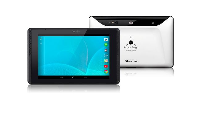 Google’s new seven-inch tablet is the first mobile device released that will access the MV4D platform to easily capture, enrich and deliver quality 3D data at scale allowing Google developers to quickly build consumer and professional applications on top of the MV4D platform.
“3D represents a major paradigm shift for mobile. We haven’t seen a change this significant since the introduction of the camera-phone. MV4D allows developers to deliver 3D-enabled mobile devices and capabilities to the world,” said Amihai Loven, CEO, Mantis Vision. “This partnership with Google offers Mantis Vision the flexibility to expand quickly and strategically. It will fuel adoption and engagement directly with consumer audiences worldwide. Together, we are bringing 3D to the masses.”
MV4D is Mantis Vision’s highly-scalable 3D capture and processing platform that allows developers to integrate Mantis’ technology into new and existing applications with ease, to drive user-generated 3D content creation throughout the mobile ecosystem. MV4D’s combination of field-proven 3D imaging hardware and software and a soon-to-be released software development kit (SDK) will ultimately serve as the backbone of 3D-enabled mobile and tablet devices.
“We are excited about working with partners, such as Mantis Vision, as we push forward the hardware and software technologies for 3D sensing and motion tracking on mobile devices,” said Johnny Lee, Technical Product Lead at Google.
Since its inception, Mantis Vision has been dedicated to bringing professional-grade 3D technology to the masses. The company’s technology will be a key component of both professional and consumer level devices and applications across a wide customer base of leading mobile technology companies, application developers and device manufacturers. Because the MV4D platform and SDK is fully scalable, it is already being planned for use in more powerful, diverse range of products in the future.
“Technology is advancing so quickly that it’s slowly replacing the surveyor.” These concerns have been voiced over and over as LiDAR scanning becomes more accessible. The most recent advance in scanning is terrestrial mobile LiDAR scanning (TMLS). This technology collects survey-grade data at highway speeds and at traditional survey costs, and in the transportation discipline it is a safer means of data collection while reducing risk for the entire project. But it has surveyors questioning the longevity of their profession. What is seen as a threat because of efficiency must be embraced in order for surveying to survive. Land surveyors are increasingly missing out on surveying work because they are not advancing in current measurement technologies. Understanding and appropriately responding to non-traditional ways will significantly contribute to the success of the surveying profession and to the clients you serve.