Leica Geosystems launches a dedicated forensics program for law enforcement

As part of its eighth annual Worldwide User Conference devoted to 3D laser scanning in San Ramon, California, USA (near San Francisco), Leica Geosystems successfully launched a program devoted specifically to the law enforcement and public safety community. The event drew law enforcement agencies and forensic professionals from around the United States and the world over a four day period October 24-27, 2010.
Of special interest was the seven-hour “live fire” shooting reconstruction workshop titled “3D Laser Scanning of Shooting Scenes and Trajectories” taught by Mike Haag of the Albuquerque Police Department’s Major Crime Scene Team. Mr. Haag has used the Leica ScanStation on dozens of cases for shooting reconstruction and he is a Distinguished Member of the Association of Firearms and Tool Mark Examiners. Over 30 law enforcement professionals attended this class on a very rainy and wet Sunday at the Contra Costa County Sheriff’s Department who provided their facility. The weather didn’t inhibit the operation of the Leica ScanStation C10 or the enthusiasm of the class which learned the fundamentals and best practices of shooting incident reconstruction and trajectory measurement using 3D laser scanning.
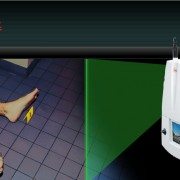
The Leica Geosystems ScanStation C10 is an easy-to-use, compact and portable 3D laser scanner that measure 3.5 million points at a scene in less than two minutes in any lighting conditions. The system does not require any special eye protection when used, is robust and captures the leveled survey-quality data required for accurate crime scene reconstruction and analysis.
In recent years many public safety agencies across a broad spectrum of law enforcement—County Sheriff’s departments, metropolitan police agencies and state investigative agencies—have acquired Leica ScanStations and now deploy them regularly for a wide range of tasks, including crime scene investigation, officer involved shootings and threat assessments of buildings and other infrastructure. Increasingly, criminal prosecutors are relying on compelling images and animations created with the system to present evidence to juries and to effectively counter the so-called “CSI effect.”
Dr. John DeHaan, of California-based Fire-Ex Forensics, Inc. an internationally recognized expert in his field and the author of Kirk’s Fire Investigation was the first speaker in the general session with a presentation titled “Documenting Fire and Explosion Scenes with Leica ScanStation Technology.” After guiding the audience through multiple cases including a home destroyed by a gas leak and an ambulance (VBIED) rigged with an explosive device as a test exercise Dr. DeHaan itemized 11 significant benefits and advantages of Leica’s ScanStation technology over other methods.
“Based on the recent, extremely rapid uptake of HDS for forensics and homeland security applications,” explained Tony Grissim, Leica Geosystems Public Safety and Forensic Accounts Manager, “the launch of a dedicated law enforcement track at this year’s conference demonstrates how seriously Leica Geosystems is committed to serving the needs of the law enforcement community.” Grissim added that portions of the program were recorded and will be available on Leica’s forensic web site at www.leica-geosystems.com/us/forensic
Leica Geosystems—when it has to be right.
With close to 200 years of pioneering solutions to measure the world, Leica Geosystems is trusted by professionals worldwide to help them capture, analyze and present spatial information. The company is best known for its broad array of products that accurately capture, model quickly, analyze easily, visualize and present spatial information. Based in Heerbrugg, Switzerland, Leica Geosystems is a global company with tens of thousands of customers supported by more than 3,500 employees in 28 countries and hundreds of partners located in more than 120 countries. Leica Geosystems is part of the Hexagon Group, Sweden.
To view this release on the web please click here
http://www.leica-geosystems.us/forensic/press_18.html
For further information regarding the use of HDS for Accident Investigation contact:
Frank J. Hahnel, III
Accident Investigation Account Manager
Leica Geosystems Inc.
407.421.0873 phone
frank.hahnel@lgshds.com
www.lgshds.com
www.leica-geosystems.us/forensic


