Tiltan TLiD Transform LiDAR Point Clouds to 3D Models in One Keystroke
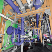
From Tiltan’s website: TLiD is Tiltan’s innovative solution for fast, automated creation of 3D maps and GIS information from LiDAR point clouds.
TLiD Main Features:
– Automatic extraction of DTM (bare earth) and DSM
– Automatic features extraction (houses, trees, power lines)
– Automatic full scene 3D reconstruction
– LAS or free ASCII txt input
– LAS, SHP, DTM and other output file formats
– Multiple input/output coordinate systems
– Integrated with a 3D Viewer
TLiD Advantages:
– Fast parallel processing for cost reduction
– No limitation on input file size
– Standalone product
– Special Applications
– Trees counting – height and size
– Power line mapping and clearance
– Line of sight
– Other applications – available on request


Leave a Reply
Want to join the discussion?Feel free to contribute!